1. Uvod o satelitskim sustavima pozicioniranja (GNSS: GPS, Glonass, Galileo)
U modernom dobu tehnologije, globalni navigacijski satelitski sustavi (GNSS) su postali nezamjenjivi alat u svakodnevnom životu i brojnim sektorima industrije. Ovi sustavi omogućuju korisnicima diljem svijeta precizno određivanje vremena, položaja i brzine, čineći ih ključnim za navigaciju, komunikaciju, kartografiju i mnoge druge primjene. Najpoznatiji među ovim sustavima je Global Positioning System (GPS), američki satelitski navigacijski sustav koji služi kao kralježnica za globalnu navigacijsku preciznost. Pored GPS-a, tu su i ruski Global’naya Navigatsionnaya Sputnikovaya Sistema (GLONASS) i europski Galileo sustav, koji dodatno poboljšavaju globalne navigacijske kapacitete i nude alternativu ili dopunu GPS-u.
1.1. Što su satelitski navigacijski sustavi?
Satelitski navigacijski sustavi sastoje se od mreže satelita koji orbitiraju oko Zemlje, zemaljskih stanica koje upravljaju satelitima i korisničkih uređaja koji primaju signale od satelita kako bi odredili svoj položaj na Zemlji s izvanrednom točnošću. Korištenjem složenih algoritama i procesa trilateracije, GNSS mogu odrediti točnu lokaciju korisnika u svakom trenutku, neovisno o vremenskim uvjetima ili položaju na planeti.
1.2. Važnost GPS-a i drugih GNSS-a u modernom svijetu
GNSS tehnologija ima širok raspon primjena koji seže od osobne upotrebe u pametnim telefonima, vozilima i satovima, do kritičnih primjena u zrakoplovstvu, pomorstvu, vojsci, i hitnim službama. Osim toga, GNSS podupire znanstvena istraživanja, omogućavajući precizno praćenje klimatskih promjena, geoloških pojava poput potresa, i praćenje divljih životinja. U poslovnom svijetu, GNSS poboljšava logistiku i upravljanje lancima opskrbe, optimizira poljoprivredne prakse kroz precizno poljoprivredno gospodarstvo, te podupire razvoj novih tehnologija i usluga poput autonomnih vozila i dronova.
Doprinos GPS-a, GLONASS-a i Galileo sustava ne može se podcijeniti; oni su ne samo preobrazili način na koji se krećemo kroz svijet, već i kako ga razumijemo i interagiramo s njim. Ovaj uvodni odjeljak postavlja temelje za dublje razumijevanje kako ovi sustavi funkcioniraju, kako su se razvijali i kako nastavljaju oblikovati naš svijet. Kroz sljedeća poglavlja, detaljnije ćemo istražiti tehničke aspekte, povijesni razvoj i buduće perspektive GNSS tehnologija, s posebnim naglaskom na GPS, GLONASS i Galileo sustave.
2. GLONASS sustav
Global’naya Navigatsionnaya Sputnikovaya Sistema (GLONASS) je ruski satelitski navigacijski sustav, koji predstavlja ključnu komponentu globalne mreže satelitskih navigacijskih sustava (GNSS). Razvijen kao odgovor na američki Global Positioning System (GPS), GLONASS ima za cilj pružiti alternativni, ali komplementarni sustav za globalno određivanje položaja, navigaciju i vremensko mjerenje. Ovaj sustav ima bogatu povijest razvoja, tehnološke karakteristike koje ga razlikuju od GPS-a, te specifične prednosti i izazove.
2.1. Razvoj i povijest
Razvoj GLONASS-a započeo je Sovjetskim Savezom 1970-ih s ciljem pružanja precizne navigacije vojnim i civilnim korisnicima. Prvi satelit lansiran je 1982. godine, a sustav je postao operativan 1995. godine s potpunom konstelacijom satelita. Nakon raspada Sovjetskog Saveza, sustav je doživio razdoblje zastoja zbog financijskih i tehničkih poteškoća. Međutim, tijekom 2000-ih, Ruska Federacija obnovila je ulaganje u GLONASS, modernizirala je konstelaciju satelita i poboljšala njegovu globalnu pokrivenost i točnost.
2.2.Tehničke specifikacije i operativne razlike
GLONASS se razlikuje od GPS-a u nekoliko ključnih aspekata. Prije svega, koristi drugačiji frekvencijski raspon za prijenos svojih signala. Dok GPS koristi metodu kodnog dijeljenja za razlikovanje signala različitih satelita, GLONASS koristi frekvencijsko dijeljenje, gdje svaki satelit emitira na svojoj jedinstvenoj frekvenciji. Ova razlika može pomoći u smanjenju interferencije signala i poboljšanju točnosti pod određenim uvjetima.
Konstelacija GLONASS-a sastoji se od 24 satelita raspoređenih u tri orbite, što osigurava globalno pokrivanje i omogućuje korisnicima da primaju signale od najmanje četiri satelita u bilo kojem trenutku, slično GPS-u. GLONASS sateliti orbitiraju na nešto nižoj visini u odnosu na GPS satelite, što također može utjecati na karakteristike signala i pokrivenost.
2.3.Prednosti i nedostaci u odnosu na GPS
Jedna od glavnih prednosti GLONASS-a u odnosu na GPS je njegova konstelacija satelita, koja može pružiti bolju pokrivenost u visokim geografskim širinama, poput sjeverne Rusije i Arktika. Ovo je posebno važno za Rusiju, obzirom na njezinu veliku teritorijalnu ekspanziju i strateške interese u tim područjima.
Međutim, GLONASS se suočava s nekoliko izazova, uključujući manju točnost u određenim dijelovima svijeta i ograničenja u globalnoj interoperabilnosti s drugim satelitskim navigacijskim sustavima. Unatoč tim izazovima, stalna modernizacija i nadogradnje poboljšavaju performanse GLONASS-a, povećavajući njegovu točnost i pouzdanost.
2.4. Sinergija s GPS-om i drugim sustavima
Suvremeni GPS prijemnici često su kompatibilni s više satelitskih navigacijskih sustava, uključujući GLONASS. Korištenje GLONASS-a u kombinaciji s GPS-om može poboljšati pokrivenost, posebno u urbanim sredinama gdje visoke zgrade mogu blokirati signale, i povećati točnost određivanja položaja koristeći veći broj satelita za trilateraciju. Ova interoperabilnost omogućuje korisnicima da iskoriste prednosti oba sustava, pružajući bolje iskustvo navigacije i veću sigurnost u određivanju lokacije.
GLONASS je, uz GPS i nadolazeće sustave poput europskog Galileo i kineskog BeiDou, ključna komponenta globalne infrastrukture za satelitsku navigaciju. Unatoč izazovima, GLONASS ostaje vitalan za globalnu navigacijsku preciznost i sigurnost, pružajući vrijednu alternativu i dopunu GPS-u i drugim GNSS tehnologijama. Njegova stalna modernizacija i integracija s drugim sustavima naglašava njegovu ulogu u budućnosti globalne navigacije.
3. Galileo sustav
Galileo je europski globalni satelitski navigacijski sustav (GNSS), koji predstavlja ključni stup europske autonomije u satelitskoj navigaciji i preciznom vremenskom mjerenju. Razvijen od strane Europske unije u suradnji s Europskom svemirskom agencijom (ESA), Galileo je dizajniran kako bi pružio visoku točnost pozicioniranja i pouzdanost, nadmašujući postojeće sustave poput američkog GPS-a i ruskog GLONASS-a u određenim aspektima. Svojim jedinstvenim karakteristikama i prednostima, Galileo igra ključnu ulogu u globalnom GNSS pejzažu.
3.1.Razvoj i povijest Galileo sustava
Razvoj Galileo sustava započeo je krajem 1990-ih kao odgovor na potrebu za neovisnim europskim satelitskim navigacijskim sustavom koji bi osigurao autonomiju u odnosu na američki GPS, osobito u svjetlu potencijalnih ograničenja i ranjivosti koje su postojale u ovisnosti o sustavu razvijenom i kontroliranom od strane Sjedinjenih Američkih Država. Cilj je bio stvoriti sustav koji bi pružao pouzdane i točne navigacijske usluge za civilne korisnike širom svijeta, s posebnim fokusom na potrebe europskih korisnika.
3.2. Tehničke specifikacije Galileo sustava
Galileo sustav je projektiran da bude sastavljen od 30 satelita (uključujući i rezervne satelite) u tri orbite na visini od približno 23.222 kilometra iznad Zemlje. U usporedbi s GPS-om i GLONASS-om, Galileo nudi nekoliko unapređenja, uključujući naprednije tehnologije za povećanje točnosti, pouzdanosti i otpornosti na smetnje. Očekuje se da će Galileo pružiti horizontalnu i vertikalnu točnost pozicioniranja unutar nekoliko centimetara za plaćene usluge, dok će besplatna usluga biti točna unutar jednog metra.
Jedna od ključnih karakteristika Galilea je njegova sposobnost da pruža iznimno točno vremensko referenciranje, što je kritično za financijske transakcije, energetsku mrežu, telekomunikacije i druge aplikacije koje zahtijevaju precizno sinhroniziranje.
3.3. Prednosti Galileo sustava
Galileo, europski globalni satelitski navigacijski sustav, postavlja nove standarde u točnosti pozicioniranja zahvaljujući upotrebi naprednih tehnologija i većem broju satelita. Obećava iznimno precizno određivanje lokacije za civilne korisnike, čime se otvaraju nove mogućnosti u različitim sektorima, uključujući transport, poljoprivredu, i hitne službe. Osim točnosti, Galileo je projektiran s ciljem pružanja usluga visoke pouzdanosti i osiguravanja kontinuirane globalne pokrivenosti, što ga čini pouzdanim izborom za kritične aplikacije širom svijeta.
Osim što postavlja visoke standarde u točnosti i pouzdanosti, Galileo je također dizajniran da bude interoperabilan s drugim globalnim satelitskim navigacijskim sustavima, kao što su GPS i GLONASS. Ova interoperabilnost omogućuje korisnicima da kombiniraju signale iz više sustava, povećavajući tako točnost i pouzdanost dobivenih navigacijskih informacija. Osim tehničkih prednosti, Galileo pruža i stratešku neovisnost Europskoj uniji u satelitskoj navigaciji, smanjujući ovisnost o sustavima koje kontroliraju treće strane i osiguravajući europskim korisnicima stabilnu i pouzdanu uslugu.
3.4. Primjene Galileo sustava
Galileo sustav nalazi primjenu u širokom spektru područja, uključujući promet (cestovni, zračni, pomorski), upravljanje hitnim situacijama, javnu sigurnost, precizno poljoprivredno gospodarstvo, outdoor rekreaciju i mnoga druga. Osim toga, Galileo donosi značajne prednosti za kritičnu infrastrukturu koja zahtijeva visoku točnost i pouzdanost navigacijskih i vremenskih signala.
3.5. Budućnost i izazovi Galileo sustava
Iako je Galileo još uvijek u fazi punog razvoja i implementacije, njegova budućnost izgleda obećavajuće, s očekivanjima da će postati vodeći globalni sustav za satelitsku navigaciju. Međutim, suočava se s izazovima uključujući tehničke izazove, potrebu za kontinuiranim financiranjem i međunarodnu suradnju, te potrebu za širom adopcijom od strane industrije i krajnjih korisnika.
Galileo predstavlja ambiciozan korak naprijed u svijetu satelitske navigacije, nudeći napredne usluge i točnost koja će imati dalekosežan utjecaj na brojne sektore i svakodnevni život korisnika širom svijeta. Njegovo uspješno razvijanje i implementacija označit će značajan doprinos Europske unije globalnoj infrastrukturi GNSS-a, pružajući pouzdane i točne navigacijske usluge za generacije koje dolaze.
4. Napredne primjene i budućnost GNSS-a
Globalni navigacijski satelitski sustavi (GNSS) su temelj moderne navigacije i pozicioniranja, ali njihov utjecaj seže daleko izvan osnovne lokacijske usluge. Napredak u tehnologiji GNSS otvara put za revolucionarne primjene u različitim industrijama, od poboljšanja javne sigurnosti do poticanja inovacija u autonomnoj mobilnosti. U ovom poglavlju istražujemo napredne primjene GNSS-a i zavirujemo u budućnost ove transformativne tehnologije.
4.1. Napredne primjene GNSS-a
Globalni navigacijski satelitski sustavi (GNSS) igraju ključnu ulogu u razvoju autonomnih vozila, omogućavajući im precizno pozicioniranje i navigaciju kroz integraciju s naprednim senzorskim tehnologijama. Ova sposobnost pruža temelj za sigurno kretanje vozila kroz različita okruženja, od urbanih do ruralnih, značajno poboljšavajući sigurnost i efikasnost transporta. Paralelno s time, GNSS tehnologija revolucionira poljoprivredu, omogućujući poljoprivrednicima da precizno mapiraju polja, nadziru i upravljaju opremom, te optimiziraju korištenje resursa. Rezultat je povećanje prinosa uz smanjenje troškova i minimalni utjecaj na okoliš, čime se poljoprivredna proizvodnja čini održivijom.
U upravljanju prirodnim katastrofama i hitnim situacijama, GNSS pruža ključne informacije za brzu i točnu procjenu štete, koordinaciju spasilačkih timova i učinkovitu distribuciju pomoći. Satelitsko praćenje također igra vitalnu ulogu u predviđanju i minimaliziranju potencijalnog utjecaja prirodnih katastrofa, kao što su poplave i šumske požare. Nadalje, GNSS je neophodan za razvoj pametnih gradova, gdje omogućuje integraciju i sinkronizaciju različitih sustava, uključujući upravljanje prometom i praćenje kvalitete zraka, u suradnji s IoT uređajima za stvaranje efikasnih, sigurnih i održivih urbanih prostora. Konačno, u svijetu dronova i bespilotnih letjelica, precizno pozicioniranje omogućeno GNSS tehnologijom ključno je za širok spektar primjena, od dostave paketa do nadzora infrastrukture, omogućavajući ovim letjelicama da sigurno operiraju u kompleksnim i promjenjivim okruženjima.
5. Budućnost GNSS-a
Budući razvoj GNSS tehnologije usmjerit će se na značajna poboljšanja u točnosti i pouzdanosti usluga, posebno kada je riječ o izazovnim urbanim okolišima gdje su signali skloni blokiranju ili refleksiji. Očekuje se da će integracija s naprednim tehnologijama, uključujući 5G mreže i sofisticiranu obradu signala, dodatno unaprijediti performanse GNSS-a. Istodobno, kako se sigurnost GNSS signala ističe kao sve važniji aspekt, s povećanim rizikom od namjernih smetnji i spoofing napada, razvoj naprednih metoda autentifikacije i detekcije smetnji postaje ključan za očuvanje integriteta GNSS usluga.
Povećana interoperabilnost među globalnim i regionalnim navigacijskim sustavima, kao što su GPS, GLONASS, Galileo i BeiDou, očekuje se unaprijediti globalnu pokrivenost, točnost i otpornost ovih sustava. Osim toga, kako GNSS tehnologija postaje sve točnija i dostupnija, pojavljuju se nova tržišta i aplikacije, otvarajući prilike za inovacije u područjima poput virtualne i proširene stvarnosti, unutarnje navigacije i personaliziranih lokacijskih usluga. Ovaj napredak obećava da će duboko utjecati na društvo, omogućavajući budućnost u kojoj je precizno pozicioniranje temelj novih inovacija i poboljšanja u gotovo svakom aspektu naših života.
5.1. Izazovi i ograničenja GNSS-a
Iako su globalni navigacijski satelitski sustavi (GNSS) poput GPS-a, GLONASS-a i Galileo transformirali brojne aspekte modernog života, njihova upotreba dolazi s nizom izazova i ograničenja. Ovi izazovi utječu na točnost, pouzdanost i dostupnost GNSS usluga, te stvaraju potrebu za stalnim unapređenjem i inovacijama u tehnologiji i infrastrukturi. U ovom poglavlju istražujemo ključne izazove i ograničenja s kojima se GNSS tehnologija suočava.
5.2. Problemi s točnošću i dostupnošću
Atmosferske interferencije poput jonosferskih i troposferskih smetnji mogu uzrokovati kašnjenja i pogreške u GNSS signalima, što predstavlja izazov za točnost pozicioniranja. U urbanim područjima, problem višestrukih odbitaka signala od zgrada i drugih struktura može dodatno iskriviti određivanje položaja, dok visoke zgrade i prirodni tereni poput planina ili gustih šuma mogu blokirati signale, ograničavajući dostupnost i smanjujući točnost GNSS usluga.
5.3. Sigurnosni izazovi
Kada razmišljamo o sigurnosti svojeg vozila, jedan od aspekata koji posebno zabrinjava je rizik povezani s namjernim smetnjama, poznatijima kao jamming, i spoofing, odnosno slanjem lažnih GNSS signala. Ove metode mogu onemogućiti ili manipulirati GNSS uređajima, uključujući one korištene za praćenje i sigurnost vozila. U svijetu gdje je tehnologija GNSS sveprisutna, njihova pouzdanost i sigurnost postaju ključni za našu svakodnevnu sigurnost.
Namjerne smetnje ili jamming ciljano ometaju prijem GNSS signala, što može privremeno onesposobiti sposobnost GPS uređaja u vozilu da precizno odredi svoju lokaciju. Ovo ne predstavlja samo rizik za sigurnost vozila ili plovila od krađe, već može imati i dublje implikacije na osobnu sigurnost i sigurnost imovine. Spoofing, s druge strane, uključuje slanje lažnih GNSS signala uređaju, što može dovesti do pogrešnog prikazivanja lokacije vozila. Ovakve manipulacije mogu omogućiti kriminalcima da “presretnu” vozilo ili ga premjeste bez znanja vlasnika.
Kako GNSS sustavi postaju sve integriraniji s različitim aspektima digitalne infrastrukture, povećava se i rizik od kibernetičkih napada. Ovi napadi mogu ciljati GNSS uređaje i sustave, s potencijalom da poremete ne samo pojedinačne uređaje, već i šire mreže i sustave koji ovise o preciznom vremenu i lokacijskim informacijama. U kontekstu vozila, ovo znači da bi napadi mogli utjecati ne samo na navigacijske sustave, već i na sve veći broj vozila povezanih s internetom, uključujući i potencijalno autonomna vozila u budućnosti.
Kao netko tko želi zaštititi svoje vozilo od takvih prijetnji, važno je biti svjestan ovih rizika i razmotriti implementaciju dodatnih sigurnosnih mjera. To može uključivati korištenje naprednih GPS praćenja i sigurnosnih sustava koji imaju ugrađene mehanizme zaštite protiv jamminga i spoofinga, kao i osiguravanje da su svi povezani sustavi vozila ažurirani s najnovijim sigurnosnim zakrpama i softverskim unapređenjima.
U konačnici, dok tehnologija GNSS nastavlja igrati ključnu ulogu u modernom društvu, osobna odgovornost i proaktivnost u zaštiti naše imovine postaju sve važniji. Razumijevanjem izazova i ograničenja povezanih s GNSS tehnologijama, možemo bolje osigurati svoja vozila i smanjiti rizik od krađe ili drugih sigurnosnih prijetnji.
5.4.Tehnička i operativna ograničenja
Iako su globalni navigacijski satelitski sustavi (GNSS) dizajnirani da budu robustni, njihova učinkovitost može biti ograničena ekstremnim vremenskim uvjetima ili promjenama u svemirskom okruženju, kao što su solarna oluja, što utječe na preciznost i pouzdanost signala. Osim toga, GNSS signali su relativno slabi, što značajno ograničava njihovu upotrebljivost unutar zatvorenih prostora ili podzemnih struktura bez implementacije dodatne infrastrukture ili tehnologije za pojačavanje signala, postavljajući ograničenja na unutarnju navigaciju i praćenje.
6. Buduće perspektive
Rješavanje ovih izazova zahtijeva kontinuirana tehnološka unapređenja, međunarodnu suradnju i razvoj alternativnih i komplementarnih tehnologija, kao što su napredni sustavi za zemaljsku augmentaciju, kvantna navigacija i razvoj unutarnjih navigacijskih sistema. Također, važno je razvijati i primjenjivati politike i mjere zaštite koje će osigurati sigurnost i otpornost GNSS infrastrukture u svijetu sve većih sigurnosnih prijetnji. Budući razvoj GNSS-a usmjerit će se na premošćivanje ovih ograničenja, povećanje točnosti i pouzdanosti usluga, te proširenje mogućnosti upotrebe u novim aplikacijama i industrijskim sektorima.
7. Zaključak
Globalni navigacijski satelitski sustavi (GNSS), poput GPS-a, GLONASS-a i Galileo, postali su nezaobilazan dio naših života, pružajući ključne usluge za navigaciju, komunikaciju, sigurnost i mnoga druga područja. Transformacija koju su ovi sustavi donijeli u različite industrije i svakodnevne aktivnosti primjer je kako tehnološki napredak može imati duboki utjecaj na društvo. Od autonomnih vozila do precizne poljoprivrede, od upravljanja hitnim situacijama do razvoja pametnih gradova, GNSS tehnologija je omogućila inovacije koje su nezamislive bez preciznog globalnog pozicioniranja i vremenskog mjerenja.
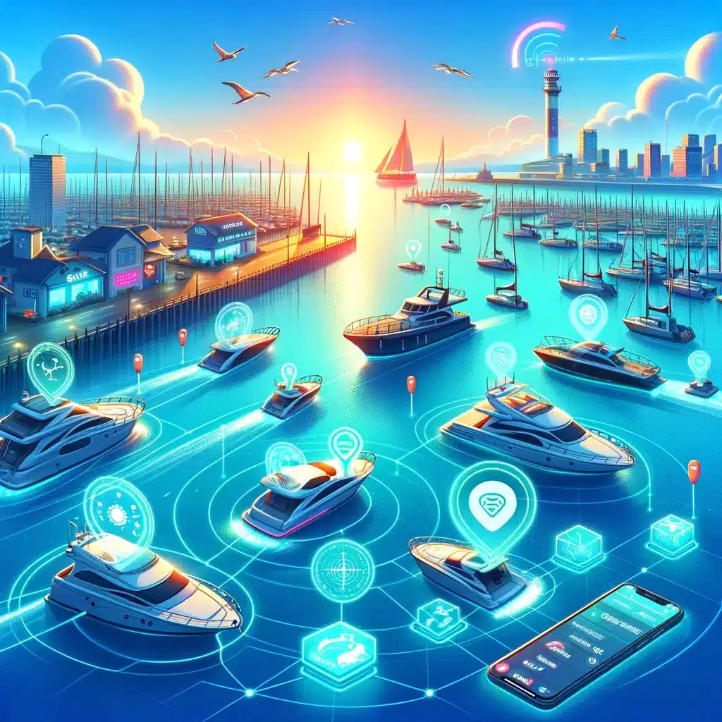
Jedan od aspekata koji zaslužuje posebnu pozornost je važnost GPS nadzora za zaštitu vlastite imovine. U svijetu gdje su rizici od krađe i zlouporabe visoki, mogućnost praćenja imovine u stvarnom vremenu predstavlja ne samo alat za njihovo osiguranje već i za mir uma vlasnika. GPS praćenje danas je postalo pristupačno, jednostavno za implementaciju i široko dostupno, čineći ga idealnim rješenjem za pojedince i tvrtke koje žele osigurati svoju imovinu.
Tvrtka Beedigital prepoznala je ovu potrebu i na tržište donosi niz rješenja usmjerenih na GPS nadzor. Nudeći moderne, efikasne i pristupačne opcije, Beedigital omogućava klijentima da jednostavno implementiraju GPS praćenje za različite vrste imovine – od vozila do vrijedne opreme. Njihova rješenja su dizajnirana tako da budu lako upotrebljiva, pružajući korisnicima detaljne informacije o lokaciji imovine u stvarnom vremenu, što povećava sigurnost i smanjuje rizik od gubitka.
Kako se tehnologija GNSS nastavlja razvijati, očekuje se da će njezine aplikacije postati još šire i sofisticiranije. Unatoč postojećim izazovima i ograničenjima, budućnost GNSS-a izgleda svijetla, s obećanjima o većoj točnosti, pouzdanosti i širokom spektru novih primjena koje će dodatno obogatiti naše gospodarstvo i društvo.
Možemo zaključiti, GNSS tehnologija je postala temelj modernog načina života, omogućujući napredak u mnogim sektorima i pružajući ključne usluge koje olakšavaju i obogaćuju naš svakodnevni život. S pristupačnim i dostupnim rješenjima poput onih koje nudi Beedigital za GPS nadzor, pojedinci i tvrtke sada imaju moć osigurati svoju imovinu i iskoristiti prednosti ove tehnologije na nove i inovativne načine.
Jedno je očito – kako tehnologija napreduje, tako će važnost globalnog satelitskog pozicioniranja samo rasti!